Free Republic
Browse · Search
General/Chat
Topics · Post Article

Skip to comments.

NOAA Forecast Path Hurricane Matther 2 pm update
NOAA ^ | October 4, 2016 | Staff

Posted on 10/04/2016 12:35:38 PM PDT by C19fan

click here to read article


Navigation: use the links below to view more comments.
first previous 1-2021-34 last
To: Gay State Conservative

I’m in NC. I realize hurricanes make it to New England on occasion. It’s somewhat unusual because the water is colder, yes.


21 posted on 10/04/2016 1:55:21 PM PDT by RegulatorCountry
[ Post Reply | Private Reply | To 20 | View Replies]

To: RegulatorCountry
It’s somewhat unusual because the water is colder, yes.

OK,so what I was suggesting is that if,by chance,the water off the *entire* East Coast (and not just Cape Cod) is warmer than normal now that could spell trouble for many,not just Florida and the Carolinas.

22 posted on 10/04/2016 1:59:12 PM PDT by Gay State Conservative (Deplorables' Lives Matter)
[ Post Reply | Private Reply | To 21 | View Replies]

To: Gay State Conservative

It’s possible that unseasonably warm ocean waters could sustain a hurricane further up the eastern seaboard.

But, the reason I brought up the eye being close to the coast is that the storm can tend to lose intensity when approaching or over land, even where the water is unquestionably warm.

Maybe we’re just misunderstanding one another. No offense intended, apologies if any was taken.


23 posted on 10/04/2016 2:04:09 PM PDT by RegulatorCountry
[ Post Reply | Private Reply | To 22 | View Replies]

To: C19fan
The Euro went bonkers this afternoon, with some ensembles having Matthew do a loop back down into Florida. I think the NHC has no idea what to do with this model at the moment.


24 posted on 10/04/2016 2:08:34 PM PDT by dirtboy
[ Post Reply | Private Reply | To 1 | View Replies]

To: RegulatorCountry
Maybe we’re just misunderstanding one another. No offense intended, apologies if any was taken.

No need to apologize...I,for one,am absolutely clueless on this general subject.I guess we'll all have to see what does,and doesn't,happen here.Hopefully things don't get too bad for anyone who *is* affected.

25 posted on 10/04/2016 2:12:41 PM PDT by Gay State Conservative (Deplorables' Lives Matter)
[ Post Reply | Private Reply | To 23 | View Replies]

To: dirtboy

https://weather.com/storms/hurricane-central/matthew-2016/AL142016


26 posted on 10/04/2016 2:13:01 PM PDT by mware (RETIRED)
[ Post Reply | Private Reply | To 24 | View Replies]

To: Gay State Conservative

From the look of the models, I’d say somebody in the US is headed for a real mess on their hands one way or the other, but hopefully no major damage and no fatalities. I don’t wish it on anyone, but hope NC’s Outer Banks are spared any heavy damage. Love the place.


27 posted on 10/04/2016 2:16:55 PM PDT by RegulatorCountry
[ Post Reply | Private Reply | To 25 | View Replies]

To: C19fan; Admin Moderator

The typo in the headline made me think of the Beaver.

....

5.56mm


28 posted on 10/04/2016 2:17:26 PM PDT by M Kehoe
[ Post Reply | Private Reply | To 1 | View Replies]

To: Peter ODonnell

don’t forget the storm sieche on inland waters.


29 posted on 10/04/2016 2:19:48 PM PDT by OregonRancher (Some days, it's not even worth chewing through the restraints)
[ Post Reply | Private Reply | To 15 | View Replies]

To: RegulatorCountry
...but hopefully no major damage and no fatalities.

Agreed.

30 posted on 10/04/2016 2:20:15 PM PDT by Gay State Conservative (Deplorables' Lives Matter)
[ Post Reply | Private Reply | To 27 | View Replies]

To: RegulatorCountry; Gay State Conservative
You're both right. The Gulf Stream curves back toward the west at the Carolina coast. The water there is warmer than the water off the coast of Daytona Beach. If the eye of Matthew hangs with the Gulf Stream, losing intensity is a low probability.

Interesting fact:
If the Gulf Stream stops, the planet dies.

31 posted on 10/04/2016 2:26:10 PM PDT by numberonepal (First they came for Sarah, then they came for Herman, and now they've come for Trump.)
[ Post Reply | Private Reply | To 23 | View Replies]

To: numberonepal

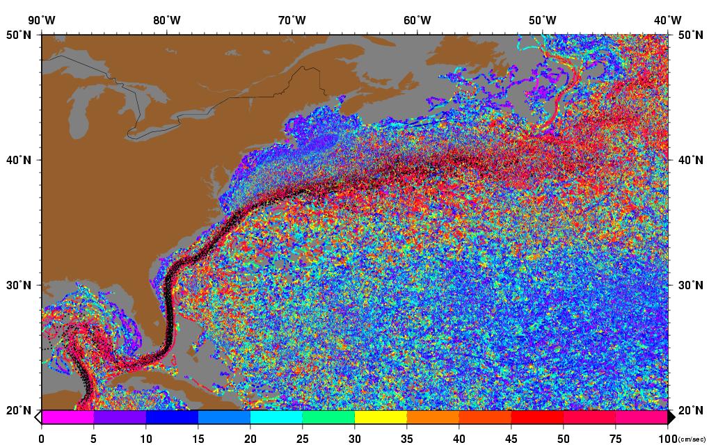
The Gulf Stream veers off and out to sea at Cape Hatteras because it clashes with the colder Labrador Current there. This is also why the ocean off Cape Hatteras is so rough. If this storm makes it to Cape Hatteras and follows the Gulf Stream, it’ll move away from land and likely dissipate at sea.


32 posted on 10/04/2016 2:29:32 PM PDT by RegulatorCountry
[ Post Reply | Private Reply | To 31 | View Replies]

Wunderground

wunderground


33 posted on 10/04/2016 2:42:06 PM PDT by deport
[ Post Reply | Private Reply | To 32 | View Replies]

To: deport

Looks like those models may indicate a grazing landfall at Cape Lookout then up and out to the north at Cape Hatteras. If it’s moving slowly, that would be bad for Atlantic Beach, Ocracoke and southern Hatteras Island.


34 posted on 10/04/2016 2:50:55 PM PDT by RegulatorCountry
[ Post Reply | Private Reply | To 33 | View Replies]


Navigation: use the links below to view more comments.
first previous 1-2021-34 last

Disclaimer: Opinions posted on Free Republic are those of the individual posters and do not necessarily represent the opinion of Free Republic or its management. All materials posted herein are protected by copyright law and the exemption for fair use of copyrighted works.

Free Republic
Browse · Search
General/Chat
Topics · Post Article

FreeRepublic, LLC, PO BOX 9771, FRESNO, CA 93794
FreeRepublic.com is powered by software copyright 2000-2008 John Robinson